From San Francisco to Pismo Beach

On day 6 of our trip from Vancouver to Tijuana we awoke in San Francisco.  From there we would continue down the coast to our stop for the night at Pismo Beach –  a  small city between San Francisco and LA.  We started the day by not going to Lombard Street.   I had seen it, and Ted was now a local, leaving only Nick wanting to drive on the crookedest street in the world.   When quizzed Nick on how he keen he was to go, given the traffic was likely to be heavy, he seemed a little diffident, so we skipped it.  As Nick started to complain about this omission, not visiting Lombard Street become one of the highlights of the trip for Ted and I.

After a brief visit to see Ted’s home and family in leafy Palo Alto, Ted took us to the best coffee shop in the area, the ZombieRunner Cafe & Running Store on South California Ave, just off El Camino Real.  Close by was the dive bar he typically visits on a Friday night – Antonio’s Nut House (sadly now closed, and the last of its kind in the affluent city). In one corner is an animated ape in a cage, which Ted claimed never to have noticed before, despite his many visits.

Carmel-by-the-Sea

From Palo Alto we headed to Santa Cruz to pick up Highway 1, and in an hour from there we were in Carmel-by-the-Sea on the Monterey Peninsular. It is a beautiful town, and much loved by artists.  There are around 100 galleries in Carmel, many of which can be found along one road – Ocean Avenue.

Our first stop was the Mission Ranch.  This nineteenth century ranch was restored by the former Mayor of Carmel, Clint Eastwood, and is now a hotel and restaurant.  We had planned to have lunch there, but finding the restaurant closed we headed to the old Spanish Mission of San Carlos Borromeo del río Carmelo.  

The Mission

Carmel Mission Pismo Beach

Carmel Mission was founded in 1770 and is one of the oldest of California’s 21 missions.   These are all located on or near El Camino Real, a road named in honor of the Spanish monarchy which provided the finance for expeditions to California.  It is also the only Spanish mission in California that has its original bell and bell tower.

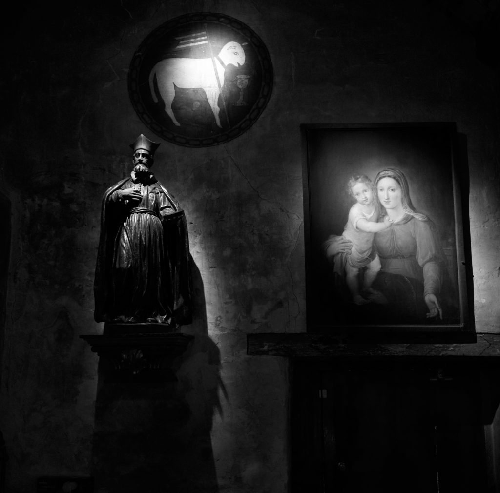
It has been carefully restored and today it is both an active parish church and a museum.  I was pleased to find a small statue and two paintings so beautifully lit in chiaroscuro fashion it would surely have found favour with Caravaggio, the orignal master of darkness and light.  I took the shot shown here with my Leica Q, and was glad of its fast f1.7 lens, which operated in the gloom at only ISO 1,600 with the aperture wide open.

Being hungry by that time, we searched for somewhere to eat and were fortunate to come across to Tree House Cafe.  Here you can dine on a combination of  dishes from the Mediterranean, Greece and Thailand on a beautiful rooftop veranda. 

Detour on Route 1

After lunch we got back onto route 1, eager to see Big Sur and to enjoy the views of the coast down to Pismo Beach. We stopped at the spectacular Bixby Canyon Bridge for me to take a few shots, though sadly the light was not great.

Just south of the bridge we found the road was closed  due to a landslide.  It was only then that we remembered that our friend James had mentioned landslides back in Portland,   Sure enough, when we examined our much annotated map, James had routed us inland to avoid exactly what we were going to do next – drive all the way back up the Monterey Peninsular before taking Route 101 to avoid the landslide.

Unwilling to give up, Ted scoured the map for another route, and eventually came up with a small dotted line that crossed the mountains that separated coastal Route 1 from inland Route 101.   Nick was skeptical of our Chevy Suburban’s off-road abilities, and we debated it for a while.  I settled the matter by declaring the dotted line a goat track, and quite impassible.  With the matter settled and no other options, we turned around and headed north.  ‘Did I mention we need to be in Mexico by Friday?’ asked Ted once again.

On to Pismo Beach

With the detour it was dark when we arrived at Pismo Beach, once famed for an abundance of clams.   Back in 1957 in an episode of Bugs Bunny, the eponymous rabbit  and traveling companion Daffy Duck emerge from a tunnel,  into what Bugs believed to be Pismo Beach with ‘all the clams we can eat.’  The clams are much diminished in numbers now, but there is still an annual festival in their honour, and the city claims to be the clam chowder capital of the world.  A large clam statue at the southern end of Price Street ensures no visitor can miss the association.

The Pismo Beach Disaster

Soon after I returned to the UK from the trip I was watching the US crime drama Ray Donovan, when I was startled to hear Bunchy, Ray’s brother exclaim ‘Jesus,  I moved my fucking family back from Pismo Beach for you, Ray!’   It’s also been mentioned in Futurama, Robot Chicken and the movie Clueless, which references the fictional Pismo Beach Disaster.

At night the back streets reminded me somewhat of Brighton in the UK – my second favourite seaside town after Deal, in Kent.   We checked in at the very pleasant Inn by the Pier, and stopped for a quick pre dinner sharpener at the bar.  Asking about the local hotspots our charming barmaid, Bobby, told us that wherever we went sooner or later we would end up at Harry’s.  Everyone did.  It sounded like destiny.

Dinner before Destiny

Not wishing to meet our destiny on an empty stomach we went for dinner at the nearby Oyster Loft at which we made a second enquiry about where we go for drinks afterwards.  We were curious to be directed to the city of  San Luis Obispo, some 20 minutes drive away.  The courteous and professional staff there at the Oyster Loft also advised us that on no account should we visit Harry’s, which was 5 minutes walk away in Pismo Beach.  I took a look at our options online; San Luis Obispo’s best known landmark appeared to be bubble gum alley – a narrow walkway with walls coated in used gum.  In local news a female resident had just been sentenced to 8 years in jail for slashing her boyfriend’s throat with a box cutter.  By way of contrast Harry’s Beach Bar and Night Club looked innocuous enough.  We decided to go to Harry’s.   

Death in Tijuana

Harry’s was not the worst bar I’ve ever been to by any stretch of the imagination, but I couldn’t recommend it.  It was large and noisy and filled with older crowd whose careworn features and less than pristine dress gave the appearance that they had endured what we call in the UK ‘a hard paper round’.  The charm that any good dive bar has was completely absent.

It was my round and I approached the bar. The woman next to me had drunk herself to the point of insensibility.  She muttered to herself and swayed alarmingly on her stool so I moved to avoid a collision.  A tall man to her right steadied her and started to take control of the situation, enquiring how she was going to get home and whether he could help her into a taxi.  He seemed genuinely concerned and helpful.  Surrounded by people who seemed likely to be considerably less noble than this, I silently gave thanks for his good citizenship.

I brought the round of beers to where Nick and Ted were standing.  They had fallen in with a group that appeared less villainous that the rest of Harry’s guests and were discussing our forthcoming trip to Tijuana.  ‘Don’t don’t do it man’, offered the largest person in the party, who was an ex US Marine.  ‘Don’t go to Tijuana.  I was there recently and I saw a man get kicked almost to death by school children’.

This alarming anecdote from an ex military type was only sightly worse than what we had heard all week.  From Vancouver to Pismo Beach we were told that a trip to Tijuana meant we would almost certainly be robbed and were likely to encounter much worse – in this case a violent end at the hands of school children.  This was to be the case until we reached San Diego and got some more balanced, first hand advice.  Ted was phlegmatic about it.  ‘As long as we remember the Spanish for help, we’ll be fine’ was his assessment.

Though the Redwoods to San Francisco

This was day 5 of our trip from Vancouver to Tijuana and our longest drive.  We had to cover some 400 miles, mostly on twisting two lane highways, from our lodge near Gold Beach on the Oregon coast  to San Francisco, a journey which would take more than 7 hours – if we didn’t stop.  This was also to be our day amongst the Giant Redwoods.  Initially, our progress was slow as we were constantly distracted by the views from the coast road.  Most of the time we were able to pull over in a layby, but to view Arch Rock, a massive rock formation along one of the most rugged sections of the Oregon coast, we needed to park up and walk a short trail.

Avenue of the Giants, San Francisco California
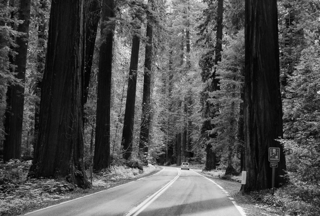
First Sight of The Redwoods

Stopping at the mysteriously named Trees of Mystery, located at Klamath, California, we were greeted by a very kitsch 49 foot tall Paul Bunyan, a giant lumberjack of American folklore, and his proportionally large Blue Ox, Babe.   Whilst these are really very large statues (most visitors would not reach Babe’s knee), they did not prepare us for the sheer scale of the Giant Redwoods we saw as we walked the trails.  Whilst they are the world’s largest single trees, they are also both the largest and oldest living things on Earth.  These incredible trees can also be viewed from the top of the forest via a gondola ride, though personally I found their majesty was best appreciated at ground level.

Taking the opportunity for brunch, we visited the Forest Cafe just across the road.  Unsurprisingly, it was forest themed and even more kitsch than the statues.   One of the specialities there is local dish called a Monte Cristo, which we sampled .  This is an XXL French toast sandwich, filled with ham and Swiss cheese, fried, dusted with icing sugar, and served with side of hash browns.   I think of it as the Mr Creosote of Croque-monsieurs.

The Avenue of the Giants

The next waypoint on our trip had the advantage of being one we could see without stopping – in theory at least.  This was the Avenue of the Giants, actually State Highway 254, which we entered from the northern end a few miles south of the town of Fortuna, and is pictured here.  The road was once was part of Route 101 until it was bypassed in the 1960s.  It was an incredible driving experience; the highway is lined with magnificent Coast Redwoods and runs parallel to a small and picturesque river.

Coast Redwoods (aka California redwoods) are also astonishingly large.   Curiously, the height these redwoods can attain is related to the availability of fog.  This is because transporting water to such great heights by conventional means is extremely difficult and the upper leaves supplement their water supply by extracting it from fog.

Shrine Tree Chevy Suburban California RedwoodsAlong the route there is a d
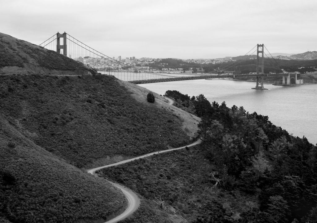
rive-through Redwood, and it seemed unreasonable not to sample it, especially as, unlike other examples, the opening in the trunk is natural.  As we paid for our $8 ticket (the tree is privately owned), we were told that our Chevy Suburban was the very largest vehicle the Shrine Drive-Thru Tree could accommodate.  Nick drove, I assisted from the passenger side and Ted took photos of the unlikely sight of a huge SUV passing through a tree.  At points there was barely an inch to spare either side, but the paint was still all on the car as we exited.

Shoreline Highway

From the Avenue of the Giants it is just 30 miles or so to California State Route 1, also known as the Pacific Coast Highway (PCH) and the inspiration for our trip.  North to South, it runs 750 miles inland from Leggett, in northern Mendocino, along the coast to Capistrano Beach, which is about 50 miles South of Long Beach.   The stretch we were on passes through Mendocino, Sonoma and Marin Counties and is known officially Shoreline Highway until it reaches the Golden Gate Bridge at Sausalito.

The Shoreline Highway is a beautiful but slow, windy stretch of two-lane blacktop that hugs the coast.  it is not what most people think of as the PCH, which is the section that runs between San Luis Obispo and Monterey, passing through Big Sur, Carmel and Monterey.  I read online that the drive between Leggett and Sausalito could be done in a day, ‘but it would be a tiring one’.  This amused me somewhat as we were already 5 hours into our drive at Leggett.

San Francisco Golden Gate BridgeGolden Gate Bridge

After about 3 hours we arrived at Sausalito, cheering in unison as we caught sight of San Francisco’s most famous landmark, the Golden Gate Bridge, resplendent in International Orange.  Ted knew of some places with good views up in the Marin headlands just north of bridge, so we headed under the 101 and up a narrow winding road, which you can see in the photo.

Whilst there are many places to shoot the bridge from this is actually one of the best vantage points in the late afternoon or early evening. Parking, however, at one of the few designated areas, is really difficult.   Once parked up we enjoyed a great view of this truly amazing piece of engineering.  It was constructed in the 1930s and had to overcome wind, fog, deep water, tides and vested interests opposed to its construction to span the Golden Gate strait.  At that time, at 746 high the towers were taller than any building in the city of San Francisco.

J Town, San Francisco

I love Japan, so I was excited to be staying at the Hotel Kabuki in the J Town (aka Japantown and Nihonmachi) part of San Francisco that evening.  This affection for all things Japanese had only become stronger since my 10 day roadtrip across the country the previous year.   There are far fewer Japan Towns than China Towns in the USA, with just 3 versus around 50.    San Francisco’s is both the largest, and oldest.

J Town covers 6-blocks and has many Japanese restaurants and shops mostly along Post Street, between Fillmore and Laguna Street.  Next to our hotel in Post Street is the Peace Plaza, which contains a 5-story pagoda, a gift from the city in Osaka in the 1960s.   We were really pleased with the recently renovated boutique Kabuki, which mixes Japanese and western influences to great effect.    We strolled the few blocks of the area and ate dinner at Izakaya Kou.  Izakaya are Japanese gastro pubs that developed from sake shops which allowed customers to consume the drink on the premises, and typically serve tapas style dishes.  The food was delicious and beautifully presented.

Back at the bar of the Kabuki we reflected that our trip was rapidly coming to an end; we had only our penultimate stop at Pismo Beach before our final night’s stay in San Diego.  The day’s drive had been an epic one of more than 400 twisting miles from our lodge in the Oregon wilderness. At a mere 254 miles the road to Pismo Beach was going to be a breeze in comparison. 

From Vancouver to Tijuana

Vancouver Library Roadtrip
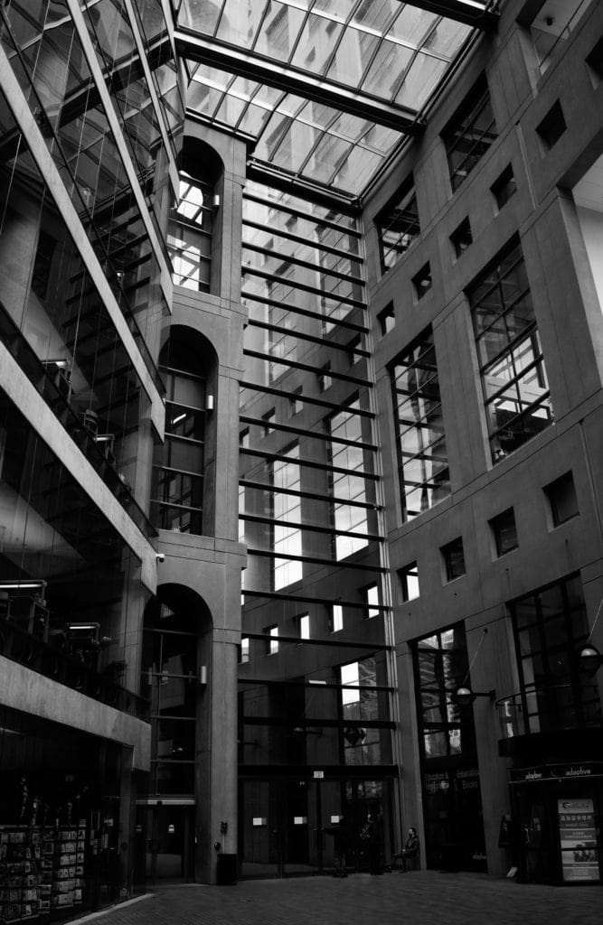
At the end of April 2018, I embarked on a week long roadtrip from Vancouver to Tijuana with two old friends.  Our planning was limited to some banter on WhatsApp and covered just the start point, the end point, and the hotels we would stay in.  All other details could be determined en route.  We excluded Alaska from the scope of the trip – albeit with some regret, as it added another 40 hours of driving.  The hotels, which were my responsibility, were rather unequally distributed, but that was where the way points fell on this trip: Vancouver, Seattle and Portland are all quite close together.

Misplaced Confidence

We were confident we could easily do the trip in a week – after all, we had covered 2,332 miles in 10 days on a Route 66 trip that took in Monument Valley (something  most experienced travellers will tell you is inadvisable) and this was somewhat shorter.  As we found out later, there is a world of difference between driving on the arrow straight roads of the South West and the winding Pacific Coast Highway.  We had also not factored in getting through the vast, traffic logged urban sprawl of Los Angeles.

We had established a high mileage rhythm on the previous roadtrip – we rolled in a 5,600 lb. beast of a vehicle, shared the driving and were untroubled by long periods of time on the road.  For us, that is what defines a roadtrip and gave us our misplaced confidence that the trip would be a breeze.

We saw so much in a week that a single post would never do our West Coast trip justice.  Instead I will break it up into sections and give selected highlights their own posts, such as Seattle’s excellent Gas Works Park.  As this post describes the start of the journey, our itinerary is below.  The mileages and time estimates come from the app Roadtrippers – which is really quite useful.  For those planning a trip like this, bear in mind that these are most direct routes, not necessarily the most scenic; our actual mileage, as you can see below, was rather higher as a result.

The Itinerary (with Link to Posts)

  • Vancouver, British Columbia
  • Seattle, Washington (141 miles, 2 hours 28 minutes)
  • Portland, Oregon (173 miles, 2 hours 47 minutes)
  • Gold Beach, Oregon (301 miles, 5 hours 31 minutes)
  • San Francisco, California (408 miles, 7 hours 15 minutes)
  • Pismo Beach, California (246 miles, 3 hours 55 minutes)
  • San Diego, California (249 miles, 4 hours 55 minutes)
  • Tijuana, Baja California (20 miles, 27 minutes)

Estimated roadtrip Total: 1,589 miles, 27 hours 20 minutes
Actual roadtrip Total: 1,823 miles, approximately 36 hours

Vancouver

My friend Nick and I flew from London Heathrow and were met by Ted, who now lives in Palo Alto, in a wine bar in Vancouver airport.  He was clutching a glass of red wine and a welcome sign that had us in stitches.   We headed to our hotel – the Fairmont, which turned out not to be the one Ted had recommended.  It turned out that there are two Fairmont Hotels in Vancouver.  Our very poor planning was already starting to show.

Having checked into the wrong Fairmont we took an enjoyable evening stroll in Gas Town, taking in the famous Steam Clock.  We finished the evening with dinner at the excellent Pourhouse and a night cap in the hotel bar.

In the morning we were up early and took a bracing walk from our hotel along the seawall to Stanley Park, stopping to admire Douglas Coupland’s superb Digital Orca and the many seaplanes in the harbour on the way.  From there we took a taxi to the iconic Capilano suspension bridge and enjoyed a walk amongst the old growth Douglas fir trees.   We took a taxi back into the city and took in Vancouver’s striking Central Library (shown here), the design of which is based loosely on the Colosseum. After that we visited Earls in Yale Town for a late lunch and then it was time to hit the road.  We couldn’t hire a car from Vancouver to San Diego (we didn’t plan to drive in Mexico), so we had arranged to pick up the hire car in Seattle.  As the train times didn’t line up with our chosen departure time we booked a car service to get us there.

An Old White Stretch

Ted took care of this and a slightly seedy looking white stretch limo duly appeared, with a Russian driver who looked like an unreformed alcoholic.  He made it plain that whilst having alcohol in the car was against the rules, he wouldn’t be checking up on us.  We loaded the car, including some local beverages, amongst which was a promising sounding beer called 33 Acres of Darkness, and set off.  The sound system in the ageing stretch was temperamental but eventually we got our play lists loaded.  We crossed the border into the USA, narrowly getting ahead of a coach load of excitable school children.  Our driver was severly chastised by US customs for bringing an alien orange with him, and was required to leave it in Canada.  Otherwise our border crossing was unremarkable.  We took the most direct route and so we didn’t see much in the way in scenery, which later reading revealed to be a mistake, but it was a fun and relaxing leg of the journey.

Seattle

Seattle was cold and overcast when we arrived and it soon started to rain heavily.  I am sure Seattle is a great city, but it wasn’t at its best for us on this trip.  Nick and I were tired from the flight, the section of bars we took in missed the mark, and whilst we had an excellent dinner at Canon, the waitress made it quite clear that we were incompetent diners who were quite incapable of ordering either food or drink without close supervision.   Between bar and restaurant the rain turned to hail.  As we passed a bedraggled line of Millennials, queuing to watch comic JP Sears and vainly trying to shelter from hail stones the size of marbles, I was glad we would soon be heading South and into better weather.

At breakfast in the W Hotel  we debated where to go in Seattle before we headed for Portland.  Naturally we all wanted to see the Space Needle.  I had read that the best place to view of it from, as part of the Seattle skyline, was from Kerry Park – so we duly headed there.  Mercifully it was dry but somewhat misty.  When we arrived I also found the sun to be entirely in the wrong place to get a good shot of the skyline.   Nevertheless I set up my tripod and did my best with the light I had.  Nick and Ted, meanwhile, started chatting with a drone photographer who was operating next to me, humorously comparing my DSLR, cable release and tripod setup very unfavourably with the agile 4K equipped aerial device.

Determined to get at least one good shot of Seattle, we headed for Gas Works Park, which was a revelation – the link will take you to my blog about it as a one of the photographic highlights of the trip.  Though it was still bitterly cold, it was bright and sunny by the time we arrived.  We were incredibly impressed by the rusting collection of industrial era technology, partly overgrown and daubed with graffiti, that forms the unlikely centre piece for the park.  There were also great views of the city skyline over Lake Union.  We spent quite a while at GWP and then went to collect our vehicle.

Getting our Wheels

Unless you are renting an exotic of some description, it is impossible to specify the exact make and model of vehicle you would like.  Our hope was for another Chevy Suburban, but aside from knowing that it would be a large SUV, we had no idea what we would get.  We were pleased to find Hertz had a Suburban for us, though it looked a little bit of a chav wagon in white compared to our preferred US Government black; Suburbans, albeit in HD form, are used extensively by the FBI.   The 2017 Chevy Suburban is 18.5 feet long, can carry nine passengers and will tow a handy 8,300 pounds.   Whilst that might sound excessive, when you are in a vehicle for up to 10 hours a day a bit of space makes a lot of difference.   With its ladder frame chassis and soft suspension it is no driver’s vehicle, but it has huge presence and the big 5.3L V8 makes for effortless mileage.   Content that we we had a proven set of wheels under us, we loaded up and headed for Portland, Oregon, with little idea what we would find when we got there.