Getting To The Faroe Islands
The date for our departure on our long anticipated road trip in the Faroe Islands finally arrived on the 25th May 2023. Our first was flight from Stanstead, UK to Aalborg, Denmark, an old city on the Limfjord where Viking ships once sailed. As it was a late afternoon flight with a decent layover we had time to head into the city for quick dinner with our Danish friends who would be accompanying us in Aalborg.
The final flight, on Atlantic Airways, arrived at Vágar Airport (Vága Floghavn in Faroese, IATA: FAE). This is the sole airport serving the Faroes on the island of Vágar. The landing was flawless, despite a nasty cross wind. The airport was built by the British Army during World War II and site was chosen largely because it was hard for German warships to observe from the sea! This is not the only legacy of the British in the Faroe Islands, as the locals apparently continue to enjoy British staples such as fish and chips and Dairy Milk chocolate.
It was late when reached the Hotel Brandan in Tórshavn so we retired after a quick night cap.
For those interested in photography, in addition to the shots on this page, you can find my black and white gallery here. Also on this site, Part I of this blog provides a bit more background to The Faroe Islands and describes why it is well worth visiting.
Where to Stay in The Faroe Islands?
We had a short debate about where to stay in The Faroe Islands, particularly as to whether we should stay in a remote location or in the city. Although we found some lovely cabins out in the wilds, eventually we decided that it would be best to base ourselves in the capital city Tórshavn. We found this decision suited us very well.
We travelled to some fairly remote locations during the day and Tórshavn felt like a metropolis in comparison. The Hotel Brandan was comfortable, hotel amenities were very welcome, the staff were friendly and the excellent breakfast set up us nicely each day.
Road Trip Day 1. Rain, Vestmanna and The National Gallery
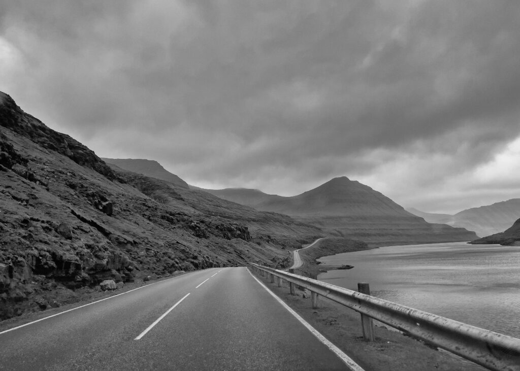
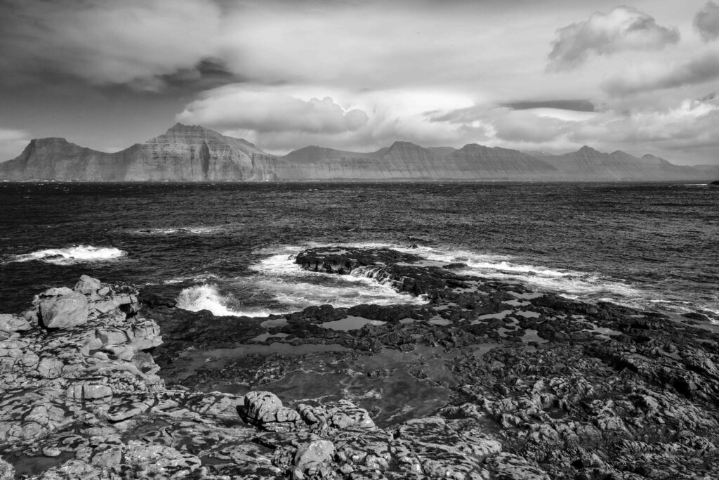
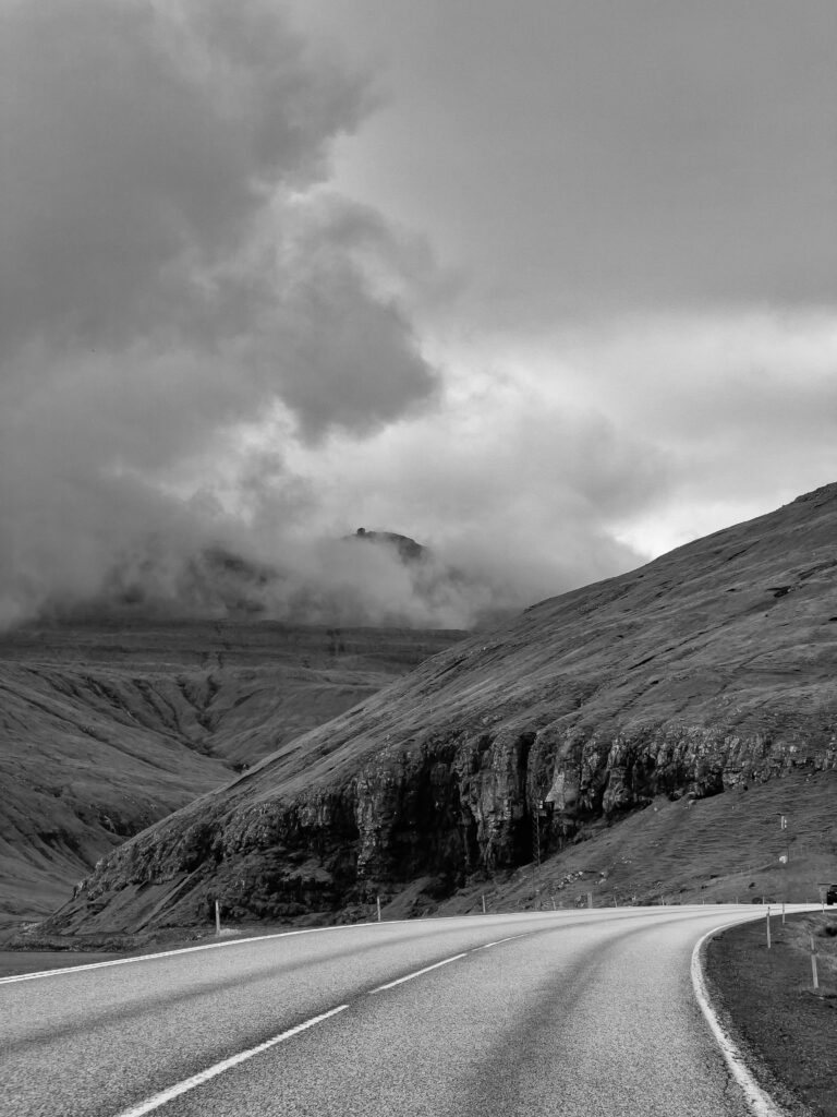
We awoke full of excitement on our first full day, and after breakfast headed for the village of Vestmanna (West Men), on the northwest coast of Streymoy, the main island. It is a short drive, just half an hour or so from our hotel. We took the scenic mountain road Oyggjarvegur and stopped near Kaldbaksbotnur, a village of just two farms, near Kaldbaksfjørður and took in the spectacular views of the fjord.
Vestmanna is a medium sized Faroese village best known for boat tours to the Vestmanna bird cliffs. The boat was sailing that day, but as we had already booked two other boat trips and it was raining we elected to visit the Saga Museum by the harbour and grab a coffee. Piracy was a common hazard in Vestmanna for centuries and features quite heavily in the various stories told by the wax figures and accompanying audio at the Museum.
The Epic Voyage of St. Brendan The Navigator
The first of the waxwork figures we encountered is of an Abbot. This figure, and accompanying audio, tells the story of St. Brendan The Navigator, an Irish Monk. He is important in the story of The Faroe Islands because of the epic journey he is said to have made across the North Atlantic in the sixth century, which was recorded in a ninth century text. During the voyage, Brendan visited an island which he described as The Paradise of Birds and a larger island described as The Island of Sheep. It’s not hard to see how this could have been The Faroe Islands, an archipelago whose name means Island of Sheep.
The National Gallery, Listasavn Føroya
We returned to Tórshavn, a name that rather pleasingly translates as Thor’s harbour. For the mythologically inclined, Thor’s most nautical myth is an account of his fishing trip to catch Jörmungandr (Jormungand) the Midgard Serpent.
On the return journey we took the other (non-scenic, but still scenic!) road from Vestmanna. We had a pleasant walk around Tórshavn harbour before heading for Listasavn Føroya, the National Gallery of the Faroe Islands, which is a great rainy day location to visit.
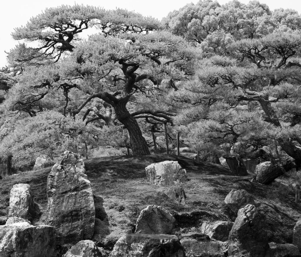
The National Gallery houses a large collection of nearly 3,000 works of Faroese art of which only around 10% are displayed in the museum’s permanent exhibition. These are divided into themes, and the museum is well worth visiting. There was a lot of great work on show, but I particularly enjoyed the work of Sámal Joensen-Mikines, Edward Fuglø (particularly ‘Colony’) and Rannva Kunoy. There are trees around the museum which is quite a novelty on the Faroes, which is treeless across most of the islands.
In the evening we dined at Áarstova, a lamb and seafood restaurant in Tórshavn. It is named after the house two famous local poets, Hans Andrias Djurhuus and Janus Djurhuus, were born in. The food, setting and service were all excellent.
Day2 . Wind, Klaksvík and Gjógv
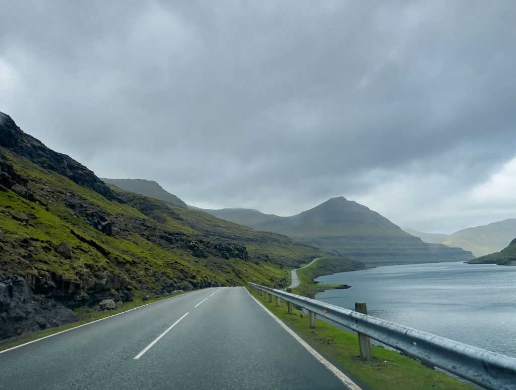
The second day we headed to Tórshavn to Klaksvík via Route 10 and the Eysturoy tunnel. This incredible feat of engineering, which took several years to compete, shortens the drive from just over an hour to a little over 30 minutes. All the sub sea tunnels charge a toll, which was applied by our hire car company. It was exciting to see the world’s first undersea roundabout (aka the jellyfish roundabout), after which we drove up the East coast of Skálafjørður, the longest fjord in the Faroe Islands, passing half a dozen or so small villages.
Encountering a Skrid
There is a very small road about halfway across one of the narrowest parts of Eysturoy which provides wonderful views of the bay of Gøtuvík. We stopped and took a few shots there. It was so windy we could hardly stand up straight to take our photographs. Reading a local weather report later, that was hardly surprising as we were experiencing a skrid – a gale force (8) wind. Beyond that, at force 9, is a stormur a strong gale, and a hvassur stormur, which blows at storm force 10.
Syðrugøta – and a Saga
We rounded the end of Gøtuvík bay, passing Syðrugøta, where The Faroe Islands’ most famous Viking age Chieftain Tróndur í Gøtu (c. 945 – 1035) is said to have lived. He is a central character in the Færeyinga saga, the Faroe Islands’ saga which tells of the arrival of Christianity, and his opposition to it.
For those interested in the strange world of the Norse I can highly recommend a book that provides a thoroughly entertaining deep dive into it: The Children of Ash and Elm. This is written by a scholarly archaeologist who happens to posses a great sense of humour.
Shortly after we passed Syðrugøta it started to rain quite heavily and the wind picked up, but this didn’t deter the women playing football on a windswept pitch in one of the small towns we passed through. We were in awe of their resilience.
On to the Northern Islands
After crossing Leirvíksfjørður, the fjord that separates the islands of Eysturoy and Borðoy, via the 6km long Norðoyartunnilin (The Northern Isles Tunnel) we drove into Klaksvík, the capital of the four Northern Islands; Borðoy, Kunoy, Kalsoy, and Viðoy. Borðoy was the only one of the four we visited, but we got great views of Kalsoy later that day from the village of Gjógv.
Klaksvík – The Harbour amongst the Mountains
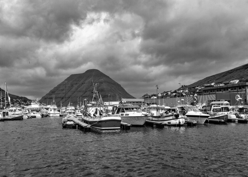
Klaksvík is the main fishing port for the islands and the second largest city. Despite this, before the sub sea tunnel Norðoyartunnilin opened it must have been quite isolated. It is in an impressive location, sitting between two fjords and surrounded by high mountains that rise from the shoreline, which made for some great pictures.
A Faroese knitwear shop, Tógvhandilin, beckoned. Klaksvík is one of three main towns with shops, the others being Tórshavn (the clear leader) and Runavík. There is a knitwear festival in the islands each year. Each of us bought something – hats, mittens and a sweater. Faroese knitwear is very well made and amazingly warm.
My hat was certainly a welcome upgrade when we were out at sea later on the trip. Before we left we had coffee and something to eat at Fríða Kaffihús, a nearby café. This recommendation came from the knitwear shop and proved to be a winner.
Spectacular Gjógv
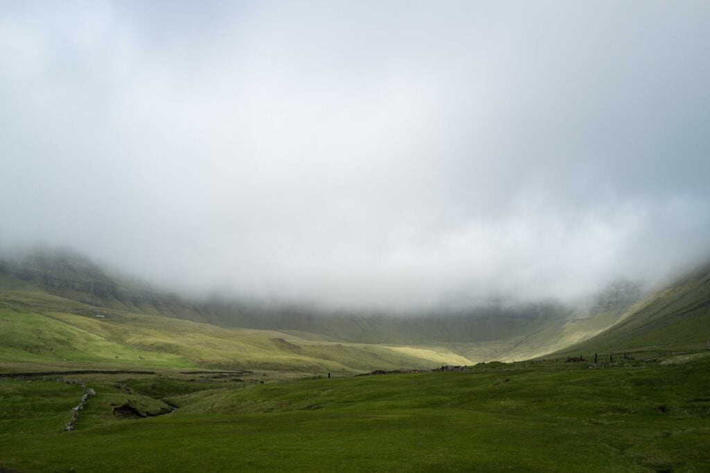
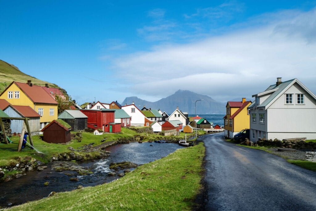
Our next destination was Gjógv, a small, colourful fishing village located on the northeast tip of the island of Eysturoy, overlooking the island of Kalsoy. It is about 30 miles from Klaksvík and is located at the end of a deep valley, with no other villages in sight.
We parked and walked down towards the village, which sits on either side of a river. The majority of Gjógv’s houses are modern but colourful and make for a lovely spectacle as you walk down the hill towards the sea. It was a lovely start, but it gets even better.
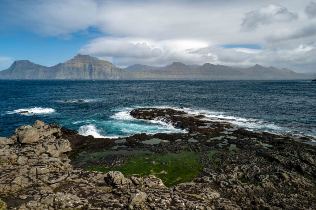
Walking down to the shore we found breath taking views over the volcanic shore to the Island of Kalsoy. One of our party observed that the coast resembled one she had seen in South Africa, and having seen something similar myself, I agreed. The village gets its name from a 200-meter-long gorge, which was used for centuries as a natural harbour and is also quite something to behold.
Some Welcome Waffles
After taking in the views for some time we enjoyed the local speciality of Faroese waffles (vaflur) with rhubarb jam at Gjáarkaffi, a tiny coffee house. It turns out that rhubarb is one of the few vegetables that grows in the tough climate of the Faroe Islands. My memories of British rhubarb and custard are not especially fond ones, but the slightly sharp jam was a superb accompaniment to the waffles.
A Different Kind of Surf and Turf
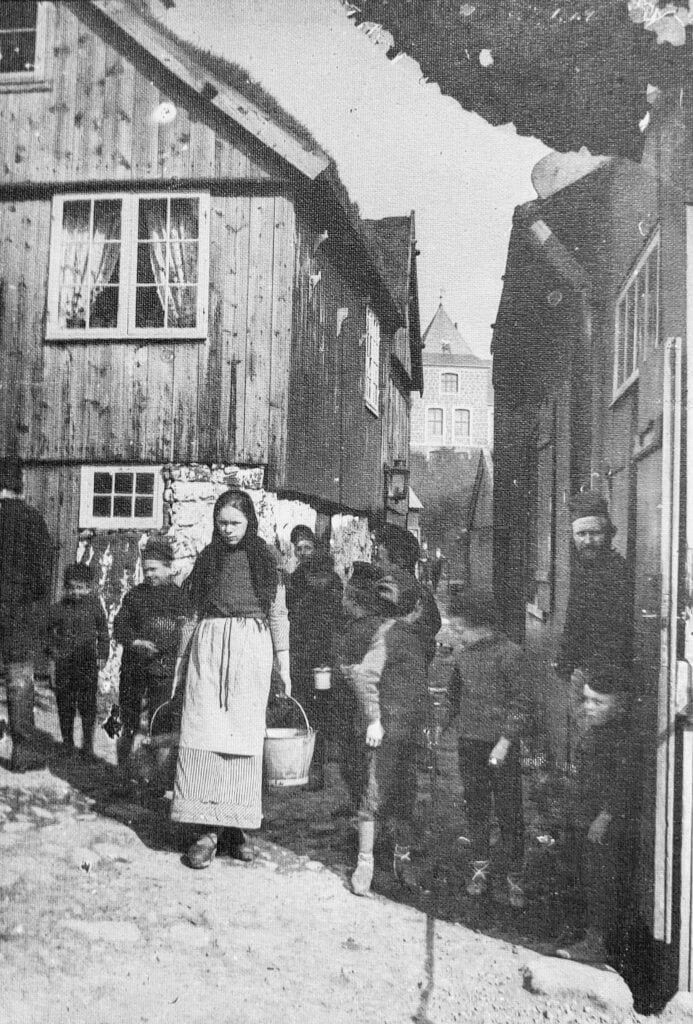
We drove back to Torshavn, well pleased with the day, and completed it with dinner at Barbara. This is a fish restaurant, which serves a multi course tasting menu described as tapas. It is set in a very old turf-roofed house which has an interior full of character. I particularly liked the old black and white photos of life in the Faroe Islands in the early twentieth century. We had high expectations of the restaurant and it did not disappoint, though like all the best restaurants in town, the bill was quite steep.
Day 3. History: Kirkjubøur and Sandur
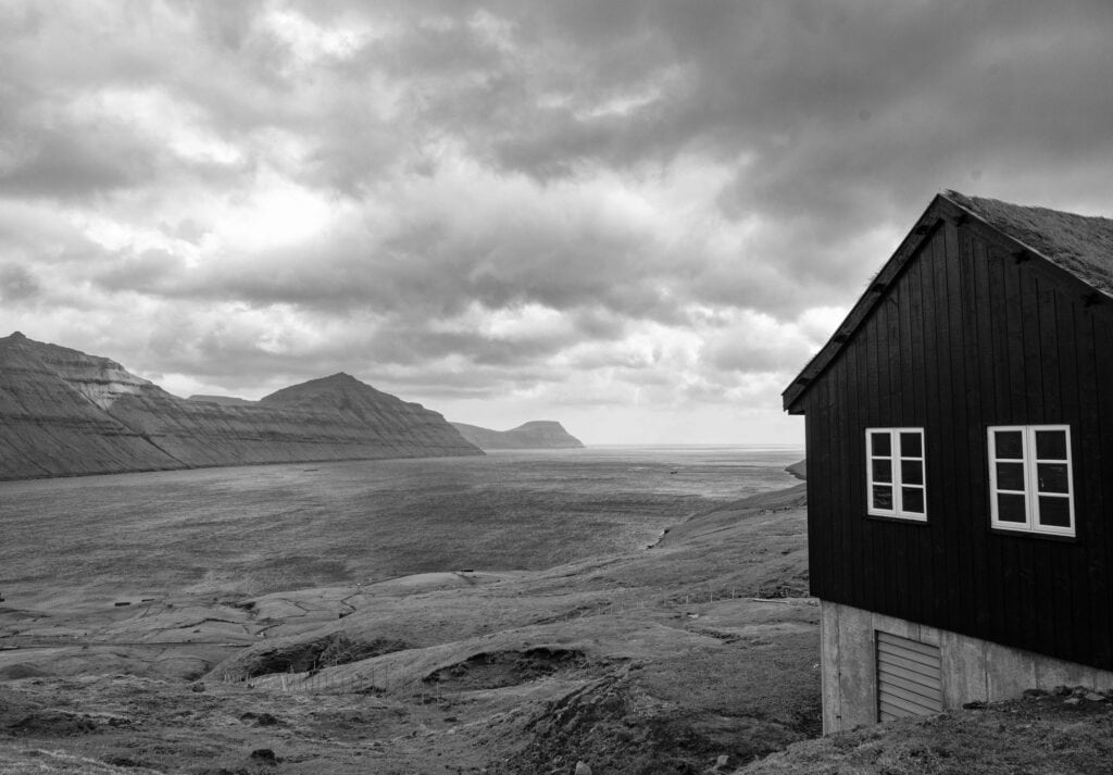
Next up on our road trip was Kirkjubøur. This is the country’s most important historical site and the southernmost village on Streymoy. Here, in close proximity, are the ruins of the Cathedral, the oldest church still in use, and an ancient log house which has been continuously inhabited since the sixteenth century by one of the leading families of the Faroe Islands. Most of the houses in the village are dressed in classic pitch-black with turf roofs and there are views of the islands of Hestur, Koltur and Sandoy.
Kirkjubøur was the seat of the Faroese bishop from the 12th century until the Reformation, and the church there was the most important in the islands. The medieval village was larger than it is today with around 50 houses. Most of these were washed away by a storm in the 16th century.
What remains is still fascinating.
Kirkjubøargarður/Roykstovan
The farm house Kirkjubøargarður is one of the oldest constantly inhabited wooden houses of the world and the oldest part, the Roykstovan, (the smoky room) dates to the 11th century. This part of the building is open to the public. The Patursson Family, who have played a number of important cultural and political roles in the history of the Faroes, has occupied the farm since 1550 and is still resident.
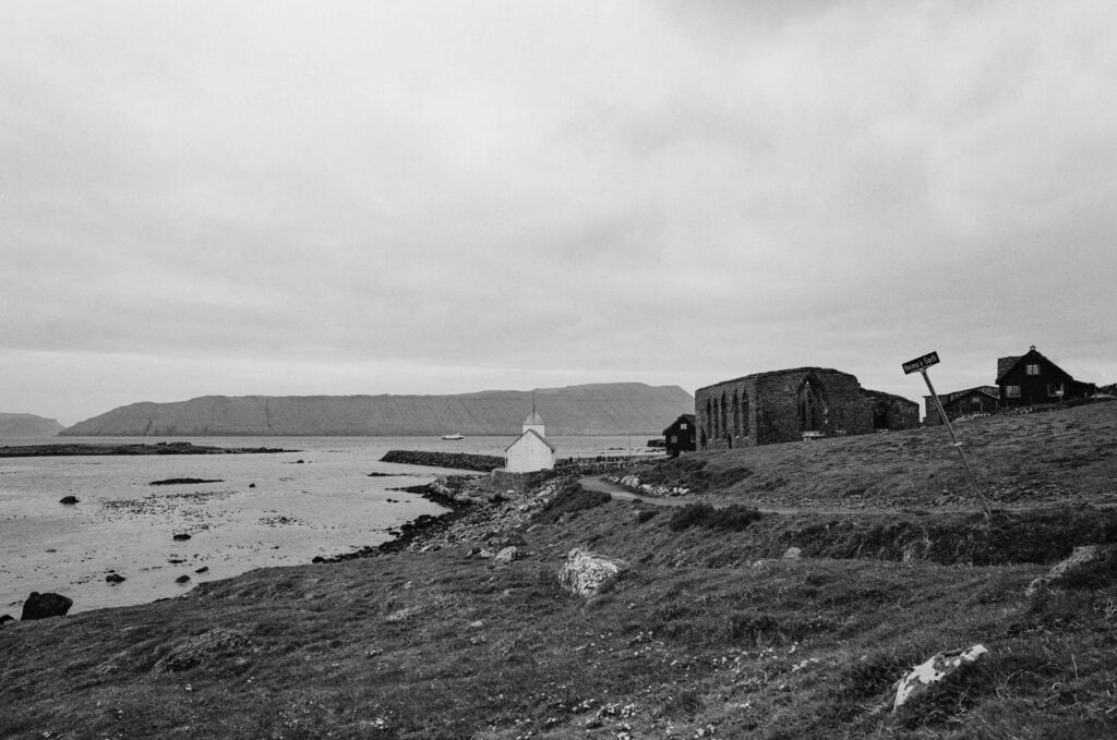
Saint Olav’s Church – Ólavskirkjan
Saint Olav’s Church or Ólavskirkjan dates from about 1250 (though I’ve seen older dates). What is agreed is is that it is the Faroe Islands oldest church still in use.
Saint Olav is the patron saint of the Faroe Islands (and of Norway). He is celebrated each year at Ólavsøka (Saint Olav’s Wake), a two-day celebration held on 28th and 29th of July. Many Faroese gather in the capital Tórshavn, some in traditional Faroese dress, greeting those they meet with “Góða (Good) Ólavsøka!”.
A set of carved pew ends from the church, known as the Kirkjubøur chairs, are now in the National Museum. We didn’t get to that museum on the trip, but there are some great images of them on a set of postage stamps issued by Postverk Føroya in the 1980s.
The museum also holds a runestone, the Kirkjubøur stone, which was found in the church in 1832. The glass art in the front gate was made by painter, sculptor, glass artist and explorer Tróndur Patursson.
The Epic Brendan Voyage – Part II
In 1977 this intrepid member of the Patursson family accompanied British explorer and historian Tim Severin across the North Atlantic on the Brendan, a replica of a replica of St. Brendan’s currach in an attempt to prove this feat was possible. It was! Setting out from Tralee, Ireland, this remarkable, two-masted boat of ancient design, wrapped with ox hides and sealed with animal grease, successfully made the 4,500 mile crossing, arriving in Newfoundland Canada. The voyage took over 13 months and the route took in the Hebrides, the Faroe Islands and Iceland.
St. Magnus Cathedral
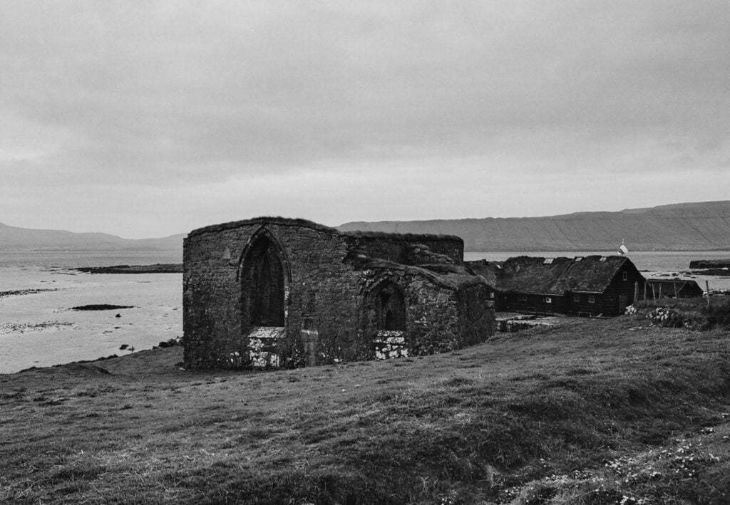
Close to both St Olav’s church and Kirkjubøargarður farm house is Magnus Cathedral, a ruined cathedral, built around 1300, which is commonly said to have been abandoned before it was a finished, though recent research suggests it did indeed get a roof. The ruins are the largest medieval building in the Faroe Islands and stand as a reminder of a time when the small village it looms over was the religious centre of the islands.
On an overcast day it has a pleasingly mysterious atmosphere, though curiously only my film shots were able to capture it. These were taken on a slightly battered Nikon F3, which was the camera that got me back into film photography.
As a black and photographer, I am fan of atmospheric ruins, particularly if they have a story to tell, and I have been photographing a local ruined manor in Oxfordshire for many years.
The Crossing to Sandy Sandoy
By way of extreme contrast to the epic Brendan Crossing, our first sailing in the Faroes was the short ferry crossing from Gamlarætt to Skopun on Sandoy. This is the only island in the archipelago with sand dunes. The ferry rolled considerably in the swell but the journey took less than 30 minutes. This service will soon be replaced by a sub sea tunnel which is under construction. Our point of arrival, Skopun, is a niðursetubygd, a unique Faroese term for a settlement or village of modern origin (19th century) which has no outlying land belonging to it.
The Old Church in Sandur
From Skopun we drove down to the town of Sandur, walked around the old church which is the 6th on the site, and took in the view. The first of these churches was an 11th century stave church. Also dating from the 11th century is a hoard of silver coins that was found in the graveyard. The sandy beaches may have welcomed settlers well before the Viking age as evidence of settlement in the 4th-6th century was found on the island in 2007.
Returning to the harbour at Skopun we took some pictures of some old abandoned boats just beyond the harbour, before boarding the ferry and returning to Tórshavn via Gamlarætt.
A Literary Lunch
We had a late lunch in the Paname Café in Torshavn after a wander in the excellent bookshop that is in the same building. The fare in the café was first rate. The bookshop, H.N. Jacobsens Bókahandil, was established in 1865 and is the oldest in the islands. The building that houses the café and bookshop has the classic Faroese grass roof and red exterior and is quite a landmark in Tórshavn. It’s a great place to hang out for a while.
Another wander in the old town was followed by a short rest at the hotel and before we knew it was it time for dinner, which we took in the hotel. The bar was crowded with Icelanders who seemed to be having a most excellent time.
Day 4. Sea Stacks and a Waterfall into the Sea
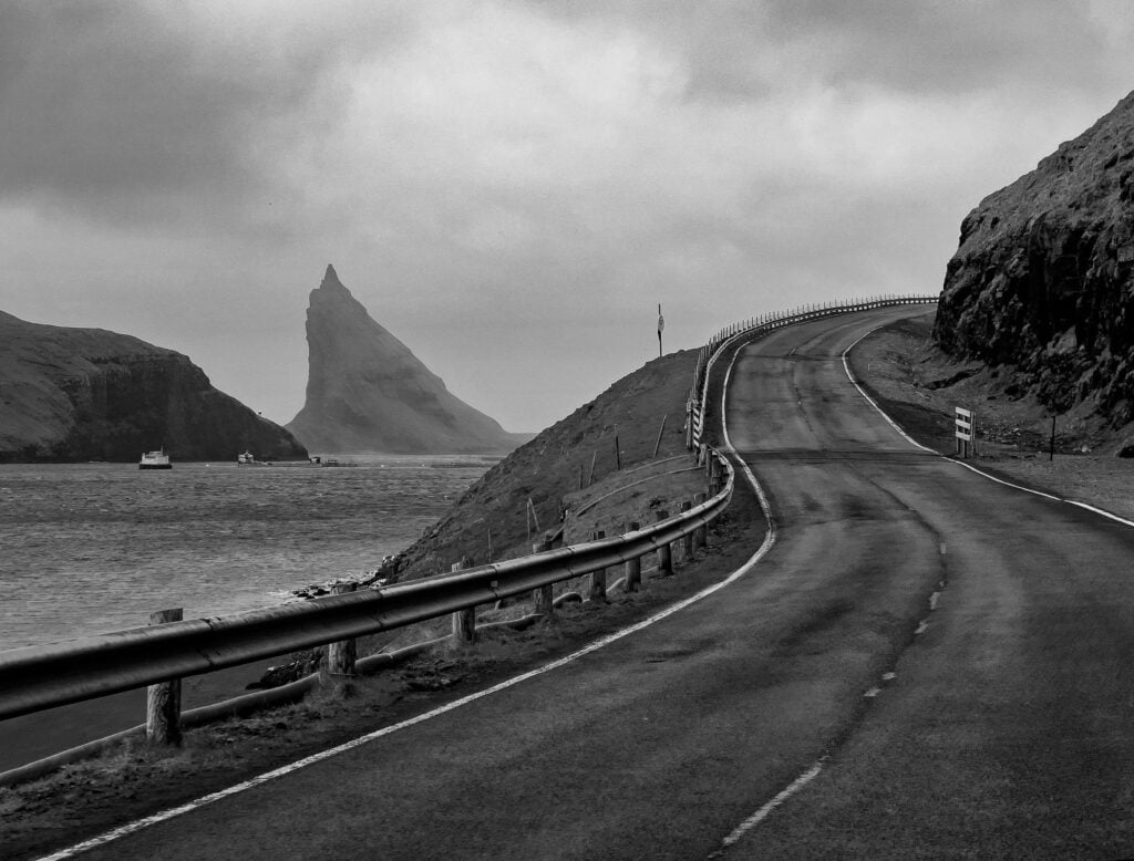
Our last day of our road trip on The Faroe Islands took us on Route 50 back to Vágar, the home of the airport in the western part of the Faroe Islands. We crossed via the sub sea tunnel and drove through Sandavágur with its landmark bright red-roofed church. Soon we reached Sorvágur, a little town most visitors frequent only to sail to the famed bird island of Mykines.
Later that day we would heading out to the sea stacks by boat. After a short wander around the harbour and town we headed on to Gásadalur and its famed waterfall that empties into the sea.
A Miss and A Myth
We passed Lake Leitisvatn, also also known as Sørvágsvatn, and more commonly the Floating Lake because of the optical illusion it presents when seen from Trælanípa cliffs. This view requires a one hour hike. Though we planned to see this, to our regret we didn’t make it.
We did however, see the silver statue of a Nykur (also known as a Nixie or water spirit) at the lake. We took this to be a prancing horse, but despite its equine form this is no pony, but a sinister mythical beast and the subject of Faroese legend.
The Nykur has the rather unfortunate habit of luring the unwary to mount it or touch it, after which its sticky skin keeps them attached and they are dragged down and drowned in the lake. The word Nykur may well be related to Old English nicor (water monster) used in the epic poem Beowulf.
Gásadalur and Múlafossur
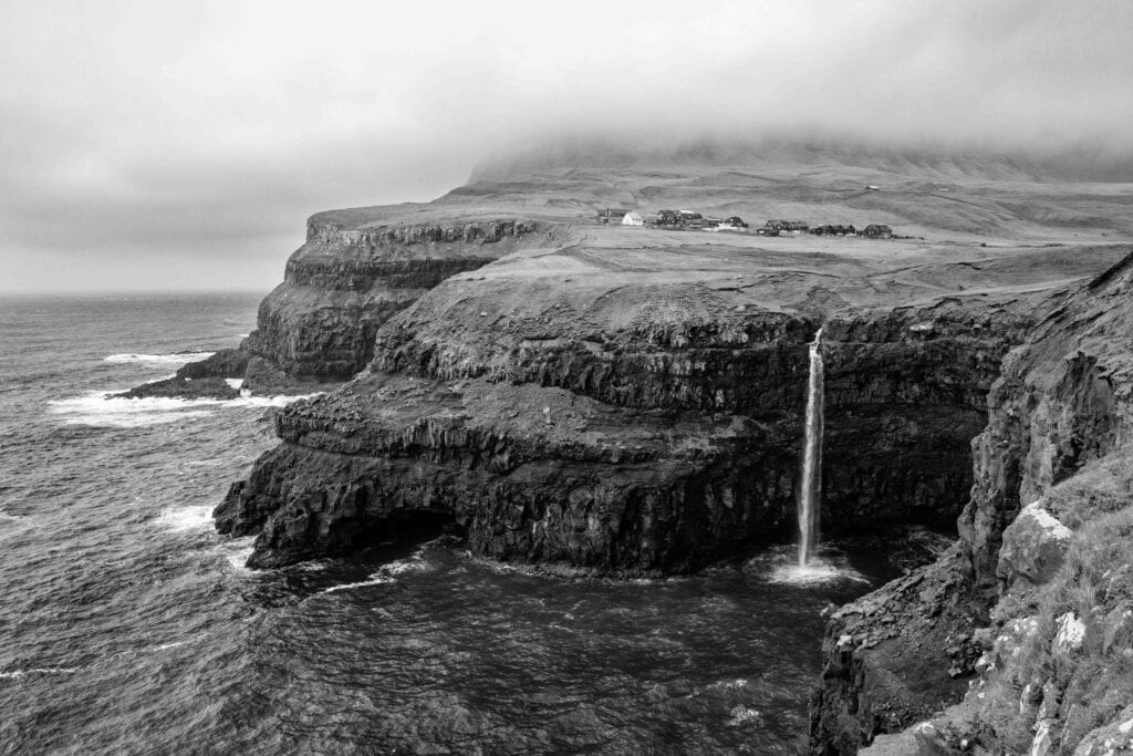
Gásadalur is home to the spectacular waterfall Múlafossur. There are only about 30 waterfalls that empty directly into the sea in the world and I had never seen one before. It is quite something, and made all the more special by the seabirds that fly in front of it.
A farm dog followed us as we walked towards the waterfall and wanted to play. We threw a stone for him which he ran after and jealously guarded for a while, before realising it. He stayed with us for some time.
Nearby the waterfall in Gásadalur is a café and guesthouse in a working farm, Gásadalsgarðurin, which sells local art and serves locally sourced food. Here I tried another local delicacy – fermented meat. The farm breeds bull calves organically and their fermented meat is used in a beef soup. The soup has been recognised at Embla, the Nordic Food Awards.
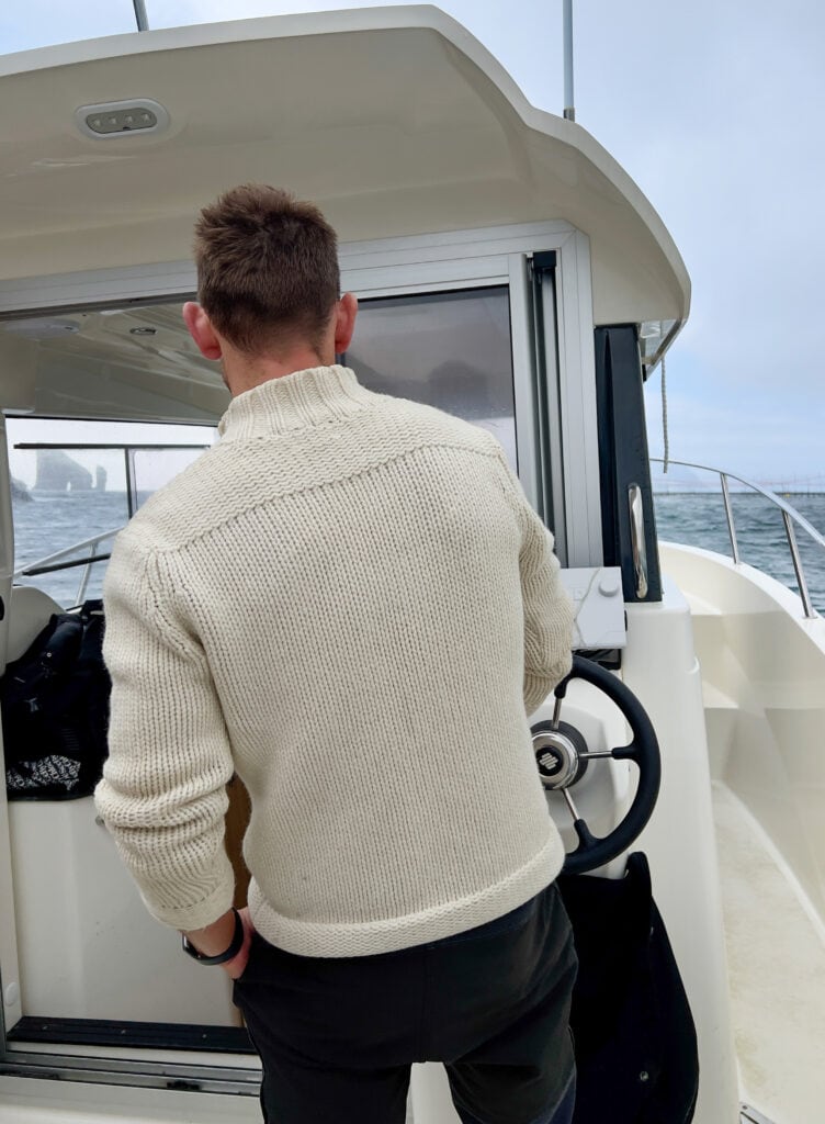
Drangarnir
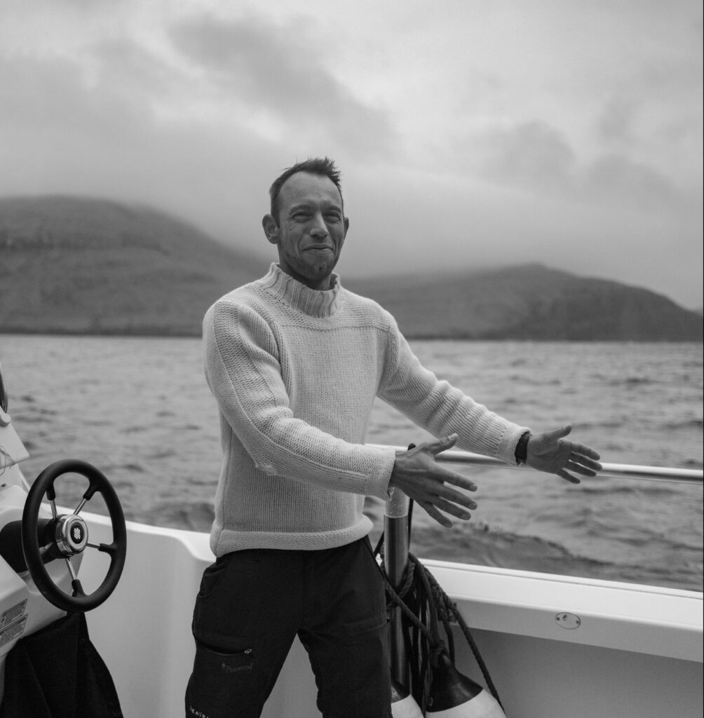
We walked around the harbour and then to the boat, where we met our skipper, an avuncular and highly capable Faroese named Elias.
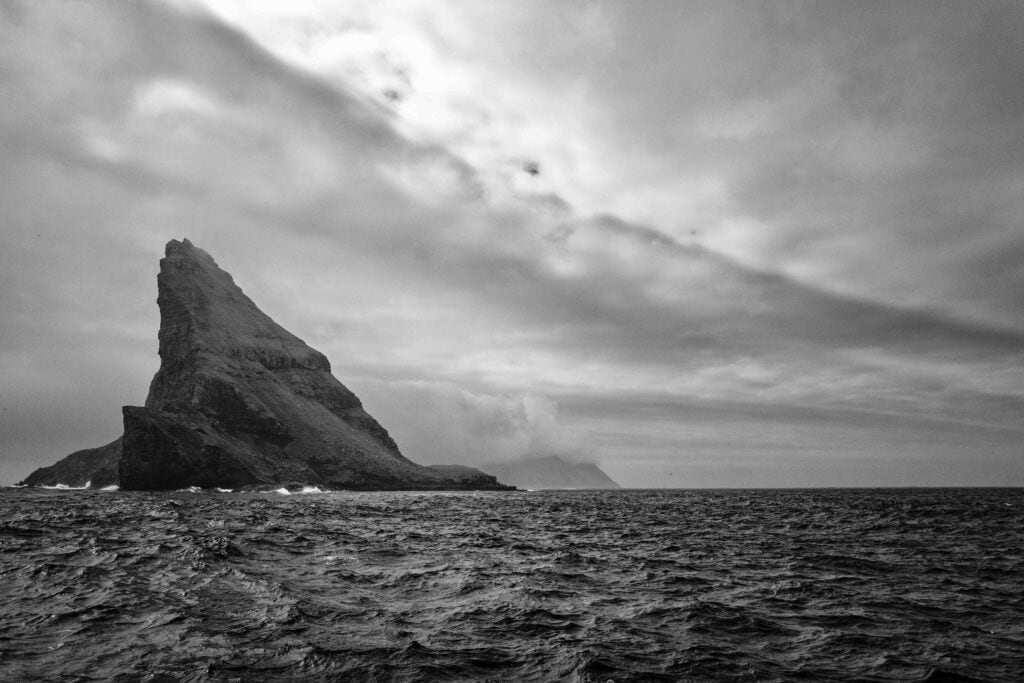
We had booked the boat to sail to Drangarnir, the Faroe Islands’ most famous rock formations. There are two sea stacks, Stóri Drangur (large sea stack), a spectacular sea arch, and its companion Lítli Drangur (small sea stack).
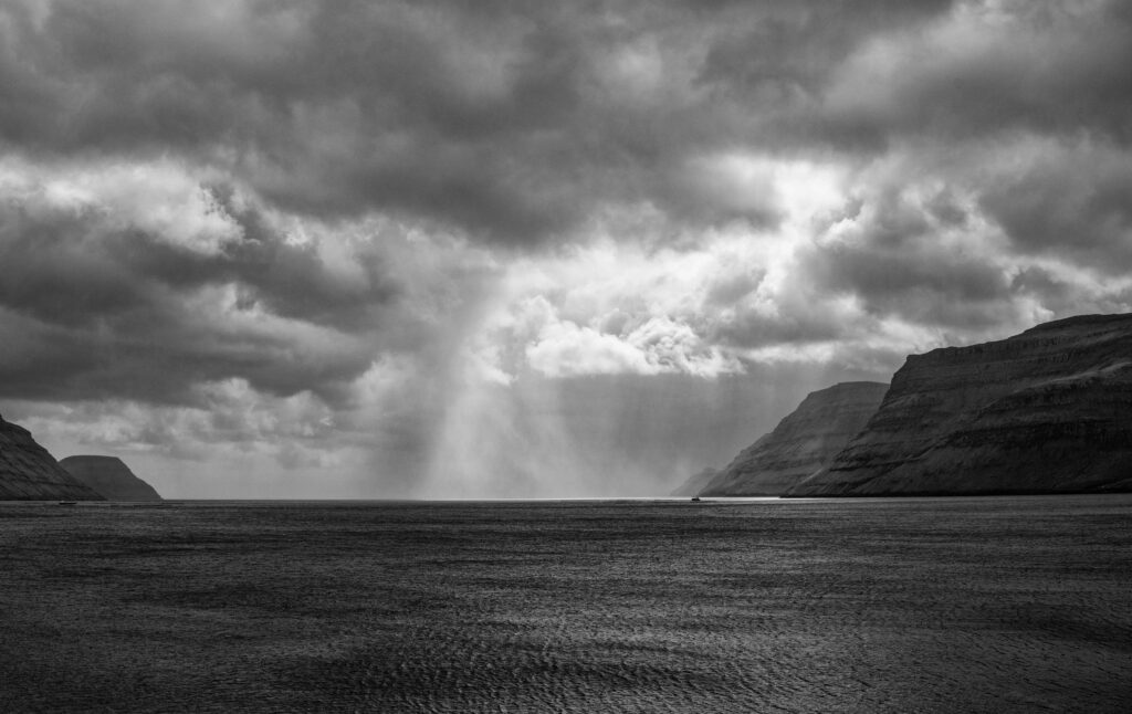
Beyond the stack stacks lie Mykines. We had booked a trip to the island earlier in our stay but never reached it due to bad weather, which is not uncommon.
Elias talked of his life in The Faroe Islands and the childhood he spent there. It was great to hear directly from a Faroese. His description of an active life, bound by community and much closer to nature made a great case for life on the islands. We also learned that our food in Gásadalsgarðurin had been cooked by his mother and served by this sister!
Bøur Beach and Village
We sailed past the picturesque village of Bøur, which must have one of the best views in the islands. It overlooks Drangarnir, as well as the uninhabited islands of Gásholmur and Tindholmur. There is a tiny beach of black volcanic sand nearby, which is likely be one of the quietest beaches in the world.
We finished the day at Katrina Christiansen – a fish restaurant with a history. The building is early eighteenth century and the informative website describes how it started as a barbershop, before becoming a general store and home to William Heinesen a well known Faroese poet, writer, composer and painter. The menu offers a choice of tasting menu, and both fare and service were excellent, with the cod cheeks and Faroese beef and mashed potatoes being the standouts.
Return and Reflections
Our return to the UK was via Copenhagen as the connection at Aalborg was just too tight for comfort. I will confess to feeling a little lost when I returned to Oxfordshire and kept my slightly battered and much annotated map of The Faroe Islands in my pocket for a few days. The post holiday blues have passed now and I am extremely happy and grateful to have been able to make the trip.
A road trip in the Faroe Islands is a much more practical proposition than I had thought and the islands are quite unlike anywhere else.
I saw some of the most stunning landscapes in the world – rugged, sculptured, dramatically lit, and painted shades of green I have never seen before. They are also largely untouched and possess a distinctive and fascinating cultural identity.
Beyond The Faroe Islands: Other Road Trips on this Site
If you’ve enjoyed reading about our road trip in The Faroe Islands, you might enjoy some of the others I have made.
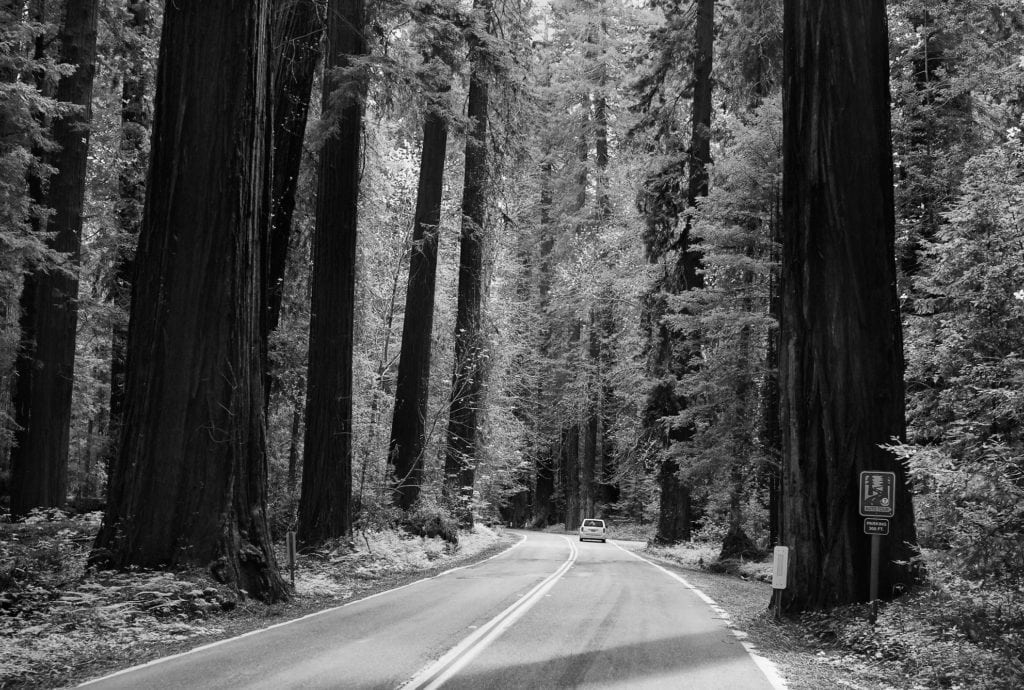 First Sight of The Redwoods
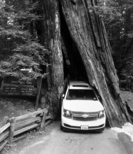 Along the route there is a d
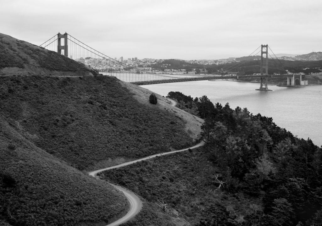 Golden Gate Bridge
 It was day four of our epic roadtrip from
 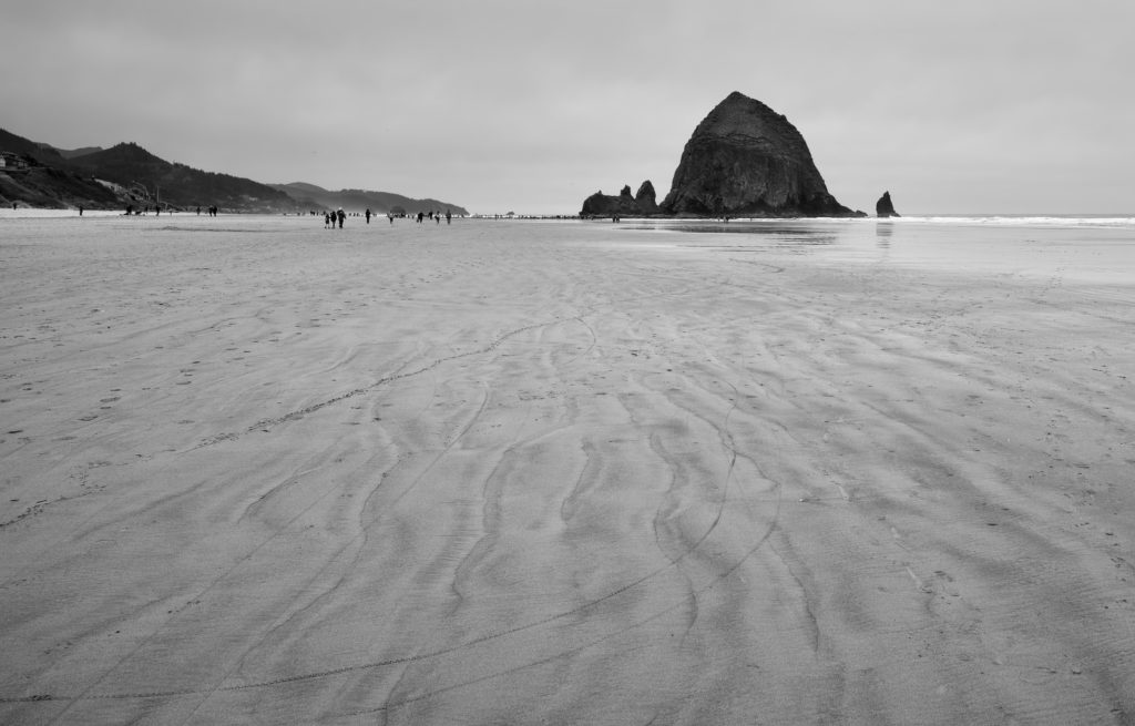 Cannon Beach
 I remembered that there was a small shop some miles back towards Gold Beach, so we set off towards the town. After a few more close calls with deer we came to the Rogue River Grocery and Tavern in the apparently invisible community of Agness. As we entered the grocery, lit with an eerie yellow light quite possibly not of this earth, I noticed a large and rather disreputable looking stuffed turkey in one corner. The head had been removed at some point and glued back on, with a visible white join. The tavern was out back and in near darkness; a lone drinker sat motionless in the dark. Reviewing our our choice of ingredients for dinner we found them be be rather limited and settled on a couple of tins of spam, some burger rolls and a copious amount of assorted beer. With the certainty of eating established, albeit not very well, we quizzed the store keeper about what dining options there might be in Gold Beach. He shook his head disapprovingly. “You won’t get anything in town at this time of night. It’s all shut up now.” He spoke to us as if we had rolled in at midnight expecting dinner, but actually it was only 8.30 in the evening.
 At the end of April 2018, I embarked on a week long roadtrip from Vancouver to Tijuana with two old friends. Our planning was limited to some banter on WhatsApp and covered just the start point, the end point, and the hotels we would stay in. All other details could be determined en route. We excluded Alaska from the scope of the trip – albeit with some regret, as it added another 40 hours of driving. The hotels, which were my responsibility, were rather unequally distributed, but that was where the way points fell on this trip: Vancouver, Seattle and Portland are all quite close together.
 On the north shore of
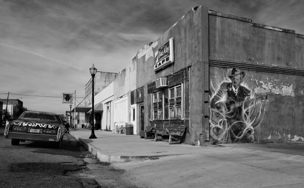 Blues Alley and Robert Johnson
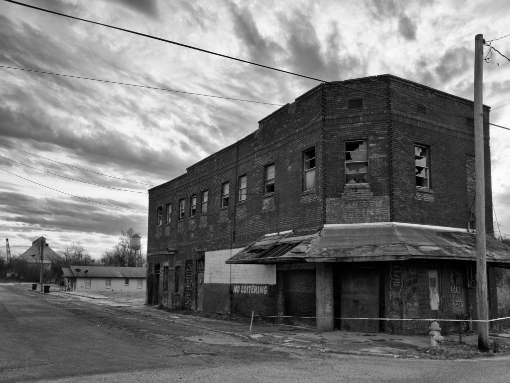 Across The Mighty Mississippi to Helena
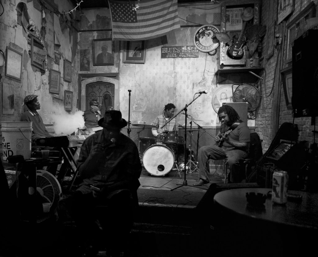 Beale Street
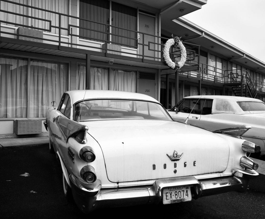 Room 306 of The Lorraine Motel
 Origins
 The typical advice you will find on the web about combining Route 66 and Monument Valley on a trip is ‘don’t’, and I will admit that we (myself and two old friends) cranked out some substantial mileage in 8 days to accomplish this (2,232 miles in all, taking in Antelope Canyon and Death Valley for good measure). It was well worth it. Taking a large vehicle like a Chevy Suburban (in FBI black) helped. My gallery for the Route 66 shots is
  In 2014 I visited Cuba. I had been shooting with professional photographer Ramses Batista for several days in